State of GRASS GIS
Markus Neteler
& Verónica Andreo, Vaclav Petras, Anna Petrasova

FOSS4G 2022 - Florence, Italy
About the presenter...

For newcomers: which GRASS GIS?
- GRASS GIS (Geographic Resources Analysis Support System), a FOSS suite used for geospatial data management and analysis, image processing, spatial modeling, and visualization.
- Originally developed by the U.S. Army CERL for land management and environmental planning (1982-1995).
- Founding member of OSGeo (2006)
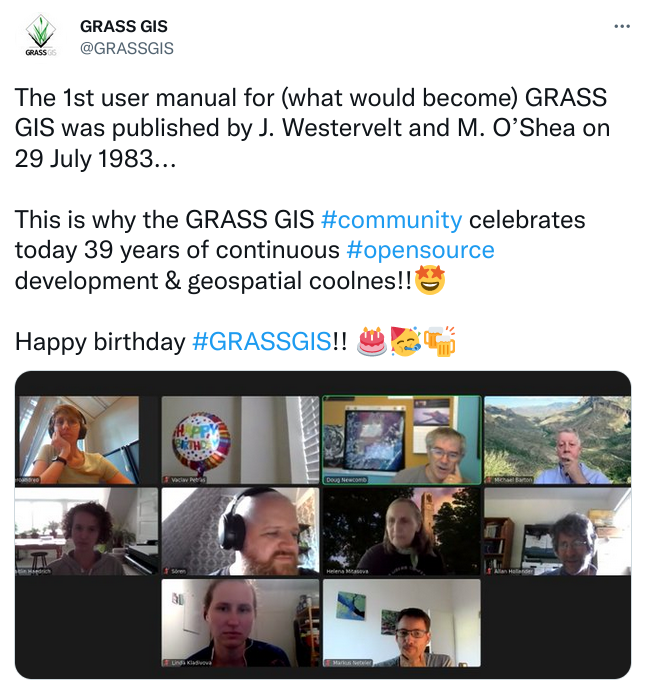
- 39 years of continuous geospatial development
All-in-one software suite
- All matured tools available right away
- Download of experimental tools possible
- Network analysis, hydrology, remote sensing, OBIA, time series, …
Roadmap
- 7.8.7, Feb 2022 Stability and fixes.
- 8.0.0, Feb 2022 New startup, data management.
- 8.0.2, May 2022 Stability and fixes.
- 8.2.0, June 2022 Jupyter, parallel r.neighbors, …
- major.minor.micro – semantic versioning:
- major (x) brings features and possibly backward incompatible changes
- minor (x.y) brings features and fixes,
- micro (x.y.z) brings fixes,
Exciting new features in GRASS 8.2+
Integration of GRASS GIS and Jupyter Notebooks
Integration of results from Google Summer of Code 2021
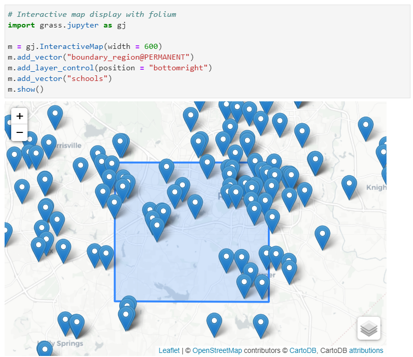
New Python library that simplifies the launch of GRASS GIS in Jupyter and the interactive display of raster/vector data
by Caitlin Haedrich
Integration of GRASS GIS and Jupyter Notebooks
- Notebooks: Mix of text, code, results, images, …
- Usage: Prototyping, reproducibility, tutorials, …
- Now in GRASS GIS: Python functions for easy integration
tinyurl.com/grass-rc2 (run in Binder)
by Vaclav Petras, Anna Petrasova, Caitlin Haedrich
New! Semantic Labels for Rasters
-
assigning meaningful labels to raster maps
(e.g.,
S2_1orred)- image classification can use sematic labels to identify bands
- different scenes can then be classified if semantic labels are the same
- organize bands within one spatio-temporal dataset
- signature files can be used for classification if band references match (raster values are semantically equal)
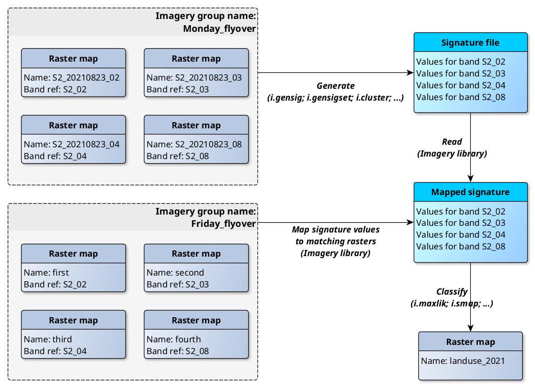
by Maris Nartiss, Martin Landa, Markus Metz
Fast LiDAR data import with PDAL
- import of any point dimension (including user defined ones e.g. from PDAL filters)
- support of 19 binning methods (including eigenvalues)
- point filtering by values in any dimension
by Vaclav Petras and Māris Nartišs
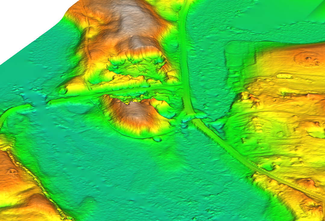
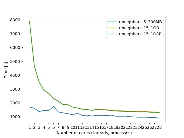
More parallelization in GRASS 8.2+
OpenMP parallelization
Integration of results from Google Summer of Code 2021
- r.series
- r.univar
- r.neighbors
- r.patch
- r.resamp.interp
- r.resamp.filter
- r.mfilter
- r.slope.aspect
+ benchmarking library
by Aaron Saw Min Sern and Anna Petrasova
Available in 8.2+
More parallel tools
- Core tools: r.sun, v.surf.rst, r.sim.sediment, r.sim.water
- Addons tools: r.sun.daily, r.in.usgs, r.mapcalc.tiled, t.rast.what.aggr, r.connectivity.corridors, r.viewshed.exposure, and 14 more
-
Parallelizing custom Python scripts:
- GridModule (by tile)
- multiprocessing, ParallelModuleQueue (by task)
A better GUI experience in GRASS 8.2+
Improved First-time User Experience
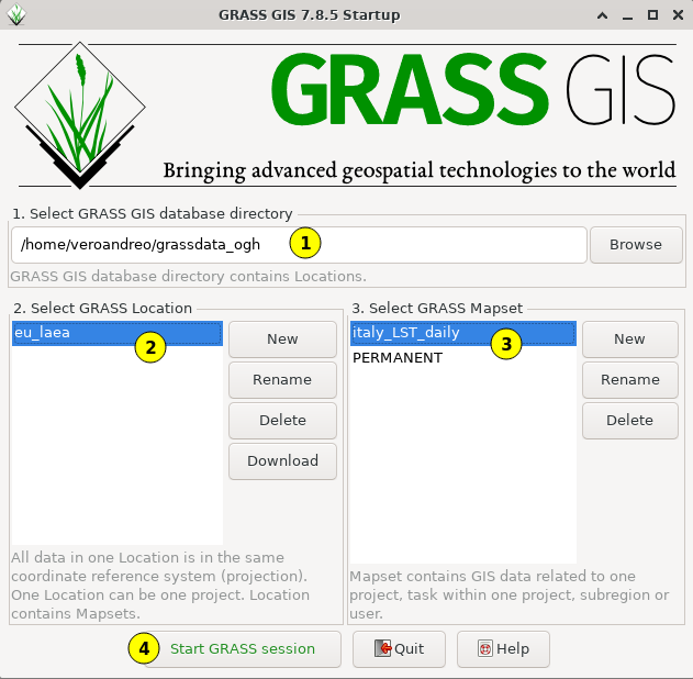
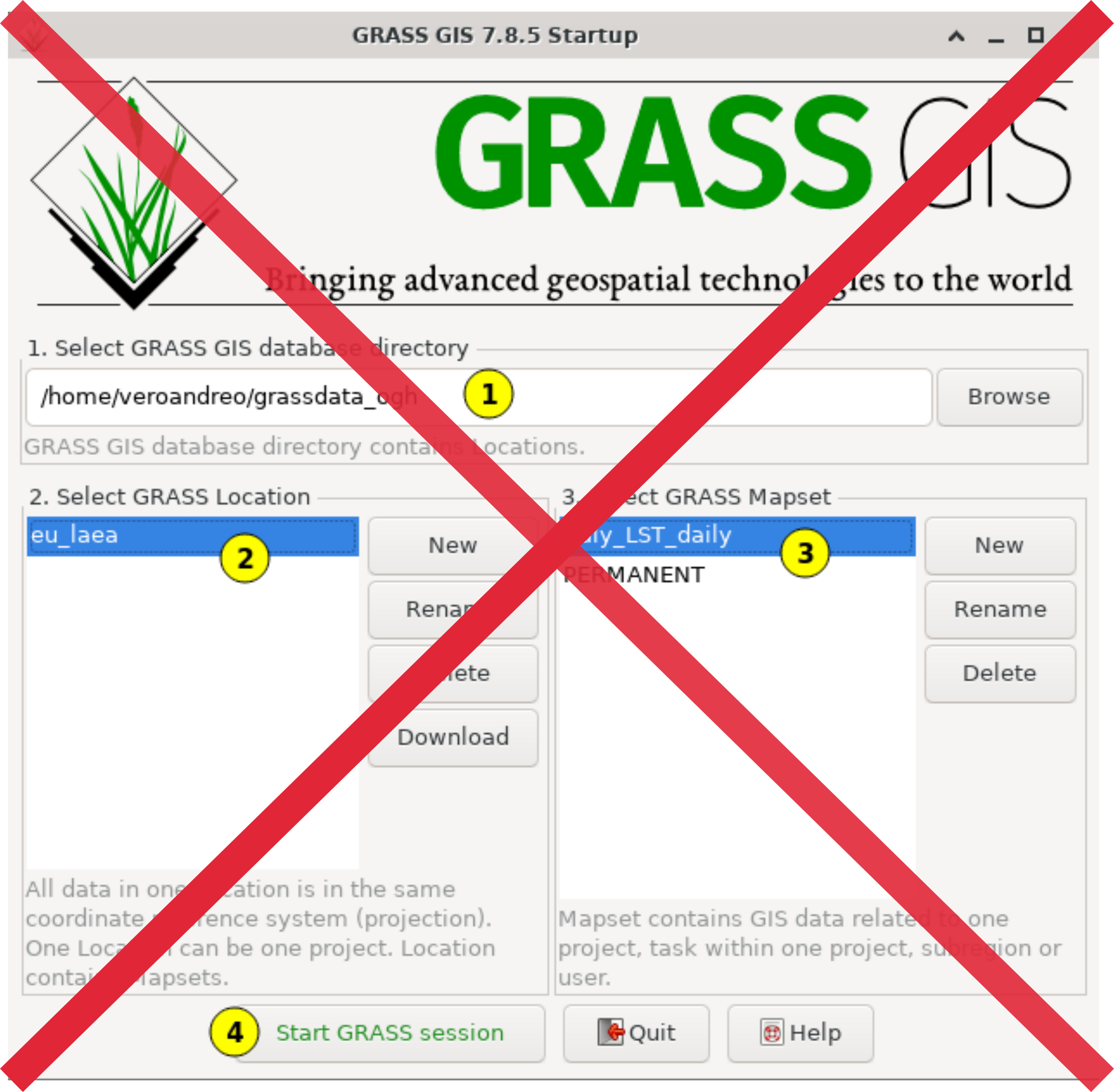
Improved First-time User Experience
Initial project sets up automatically. Guidance provided for next steps.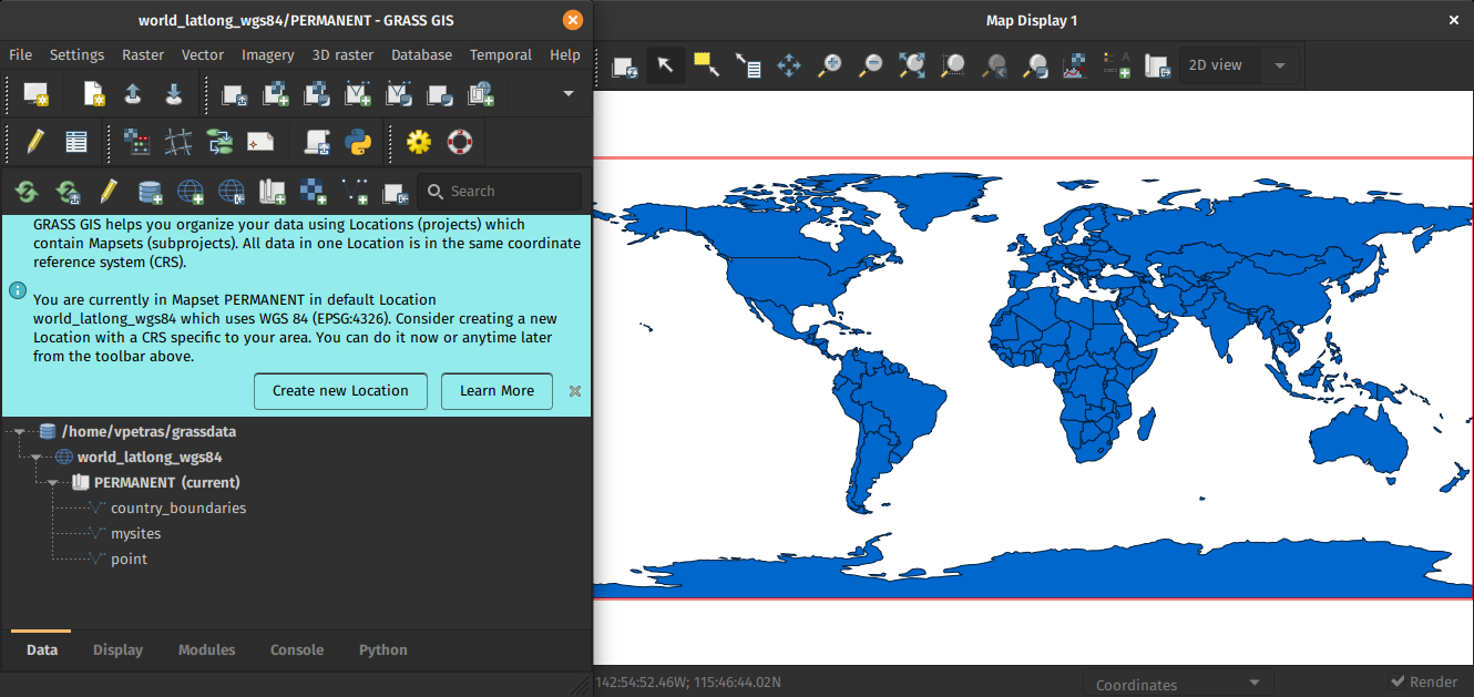
by Linda Kladivova & rest of the community (many reviews, calls, user surveys, …)
Single-Window GUI
Integration of results from Google Summer of Code 2021
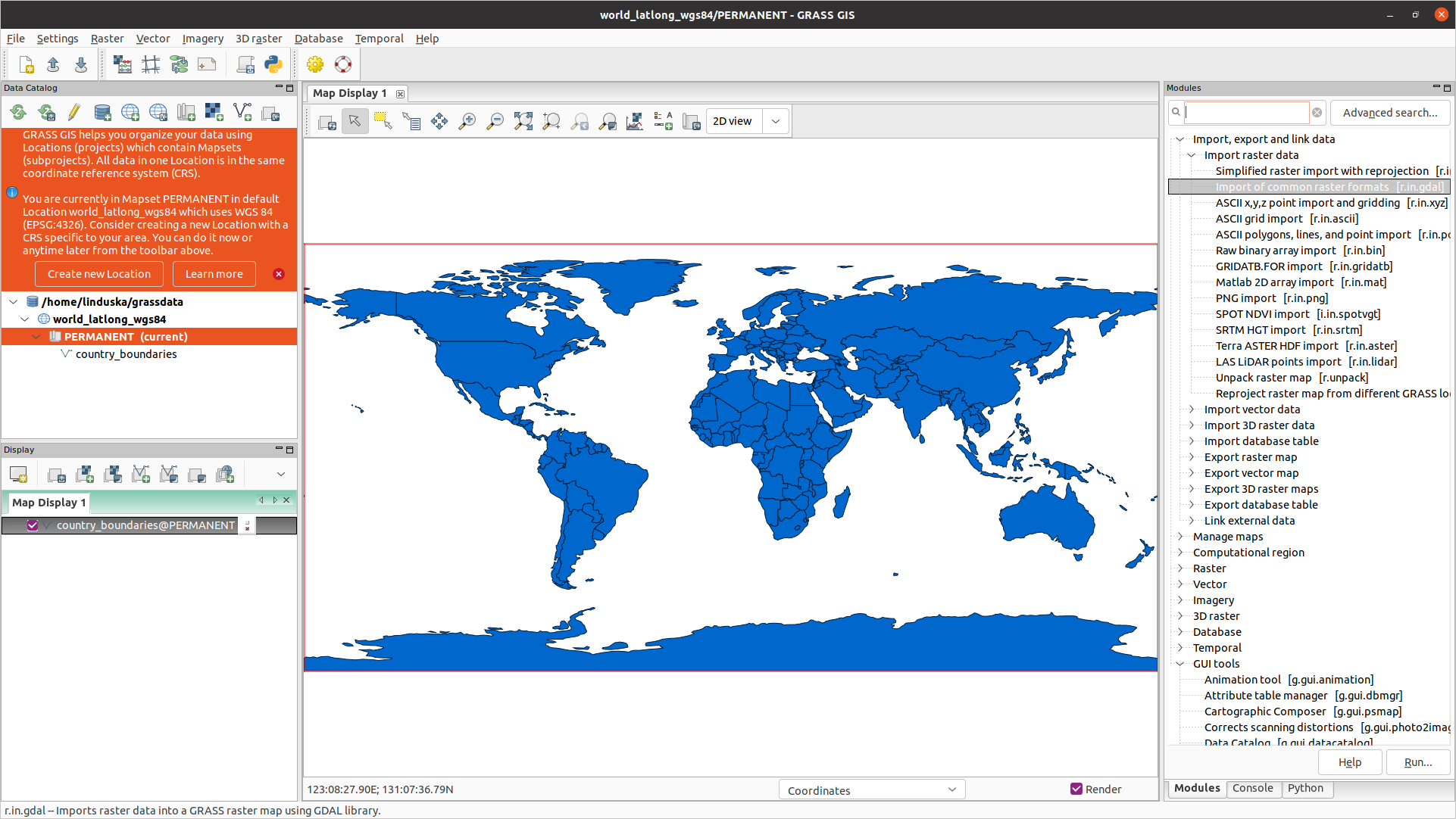
One GUI window with optimized layout with dockable widgets.
by Linda Kladivova
Available in 8.2+: Settings > Preferences > General
Code quality and automated releases
Improved and robust code quality checks: GitHub Actions
- Python code formatted by Black.
- Python code checked against Flake8.
- Most of warnings in C code removed and now checked.
- Code tested with CodeQL.
- Flake8 and Black checks also for Addons.
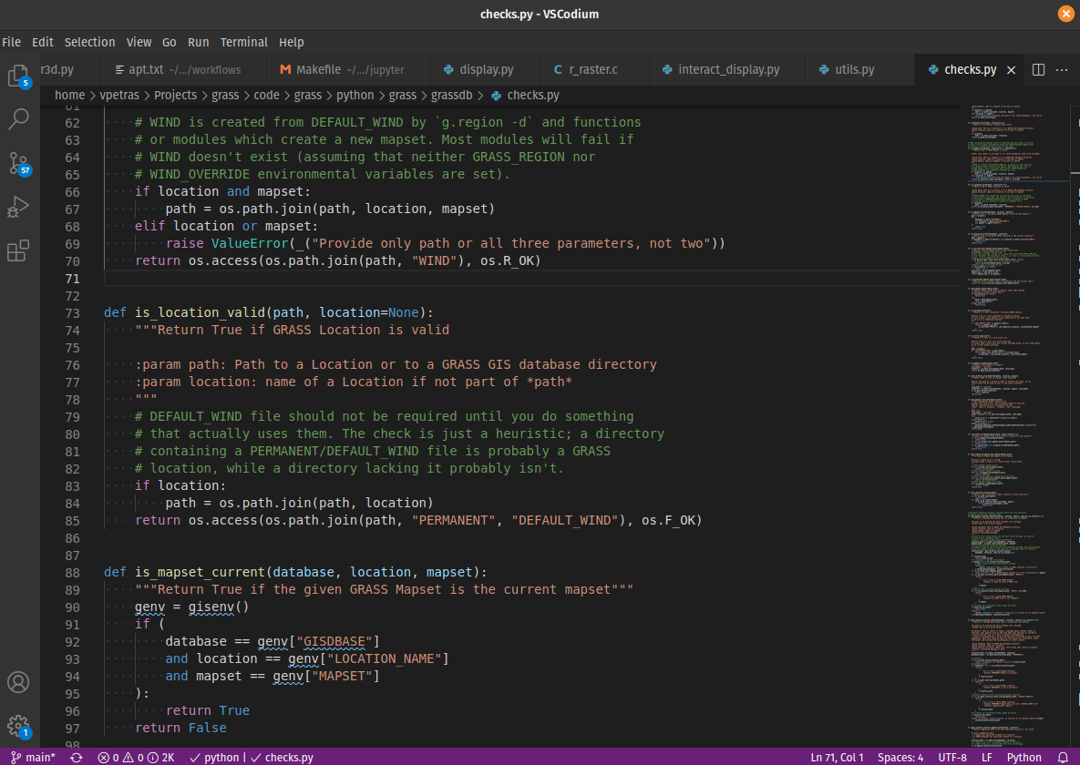
by Nicklas Larsson, Vaclav Petras, Anna Petrasova, Carmen Tawalika, ...
Automated releases from GitHub
Turning git commit entries into a release page
- log message parsing, categorization for the subsection
- publishing of source code and auto-generated release notes
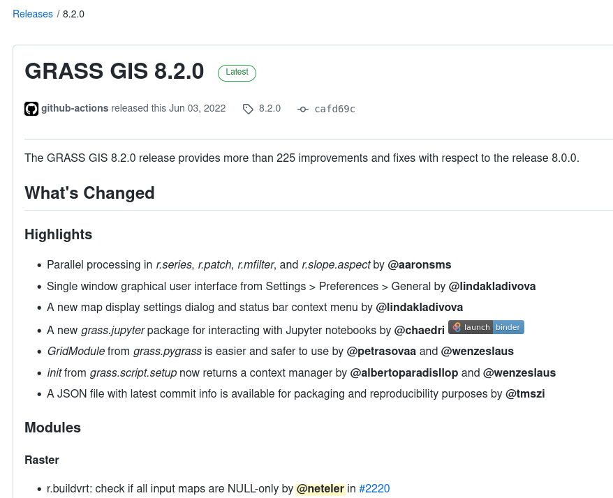
by Vaclav Petras (procedure support by Markus Neteler)
Selected addons contributed by the community
Spatial Query of Projections
g.projpicker queries projections spatially using user-drawn geometries and set-theoretic logical operators. It requires ProjPicker.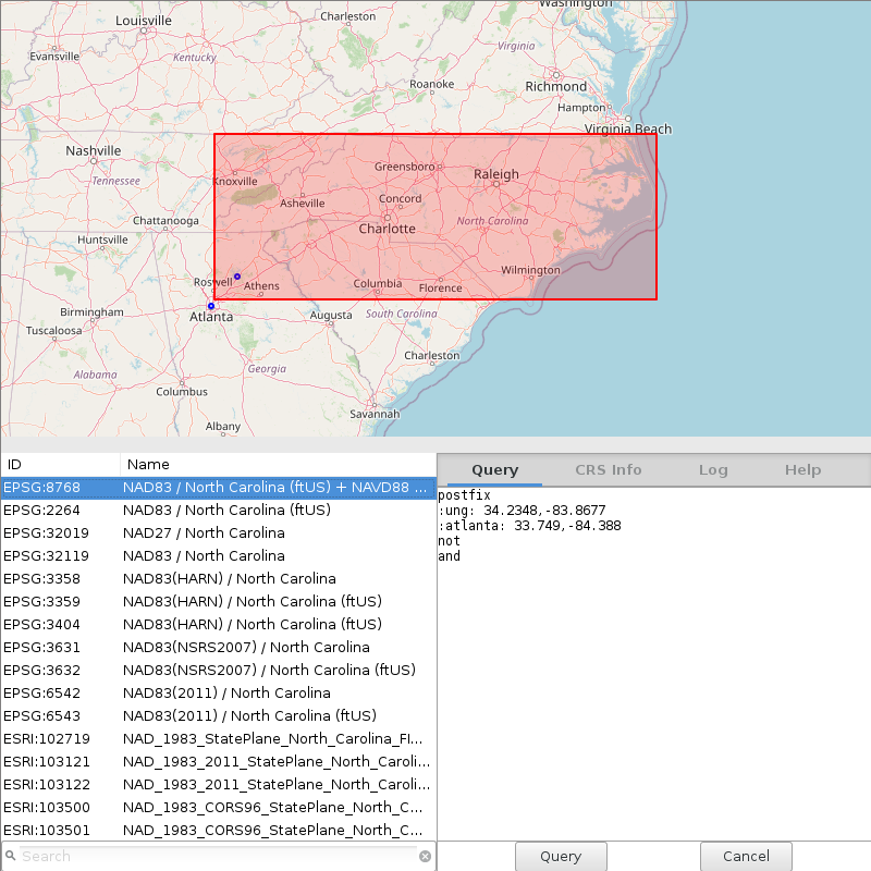
addon by Huidae Cho
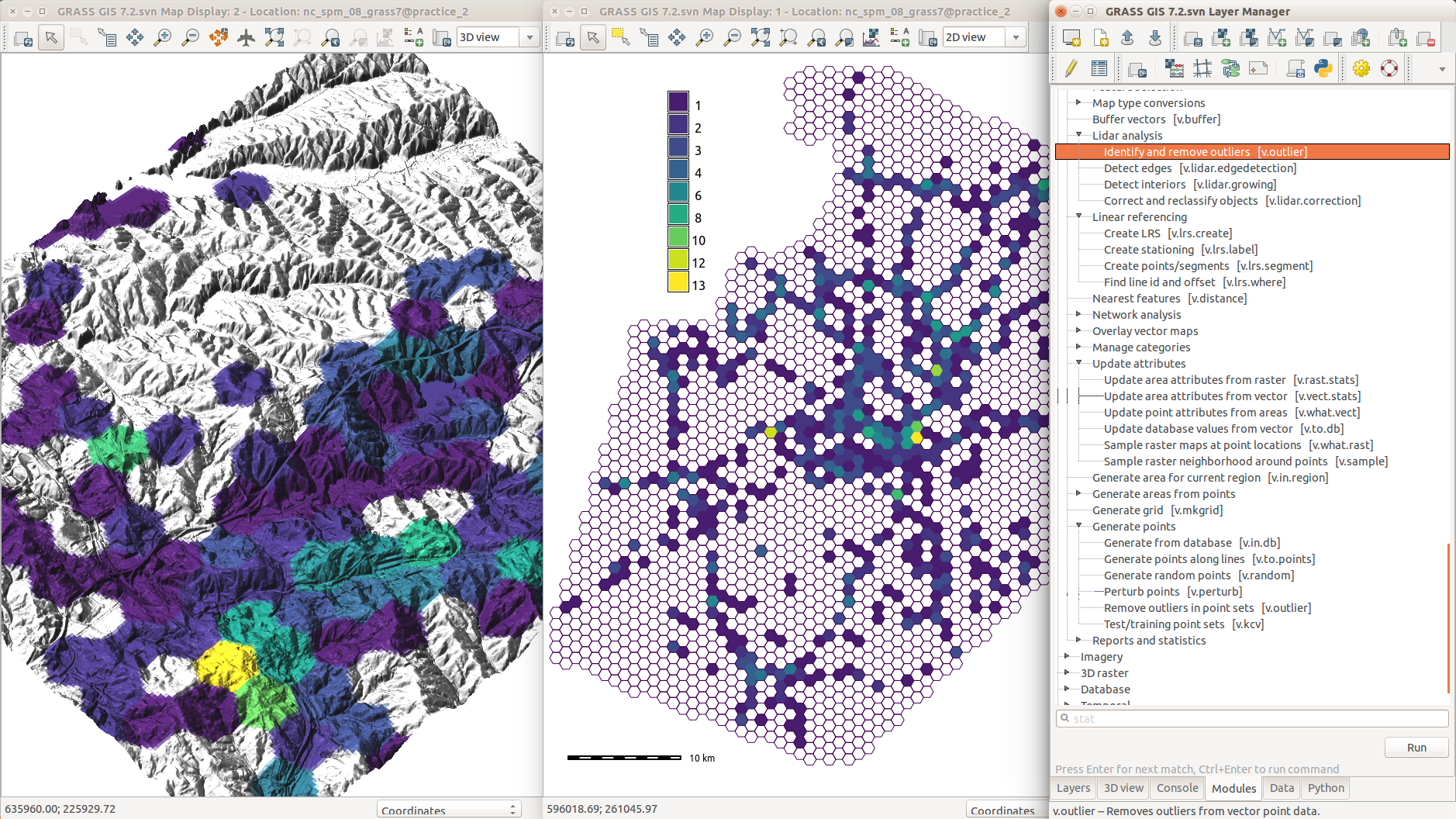
Can you see that landslide??
r.survey allows to assess whether objects of certain size could be detected by an observer moving along roads or sitting on a flying object
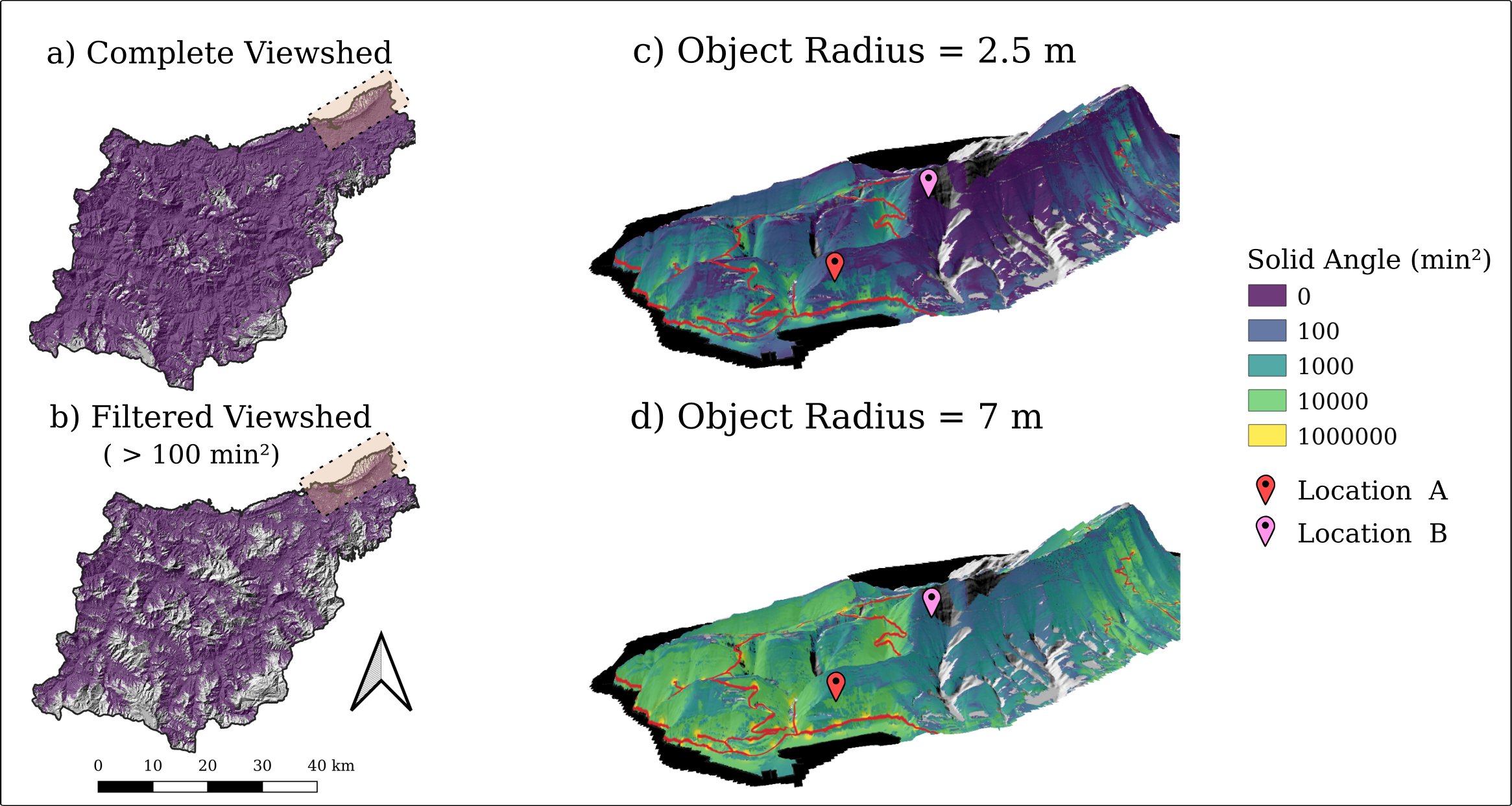
addon by Ivan Marchesini
Tap directly into FAIR data warehouses
GRASS GIS understands netCDF data that follows the CF-convention
- m.crawl.thredds: Lists URLs for netCDF datasets on Thredds servers
- t.rast.import.netcdf: Makes Spatio-temporal data in netCDF format directly available for analysis in GRASS STRDS (also without downloading)
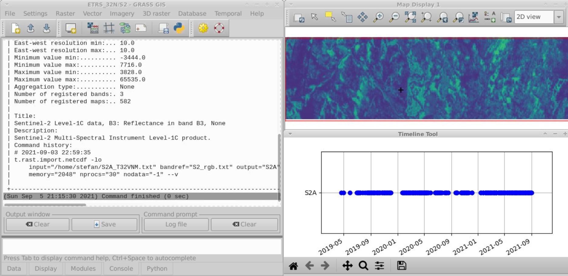
Enjoy data delivered right into your GRASS GIS database from e.g.:

by Stefan Blumentrath (Norwegian Institute for Nature Research - NINA)
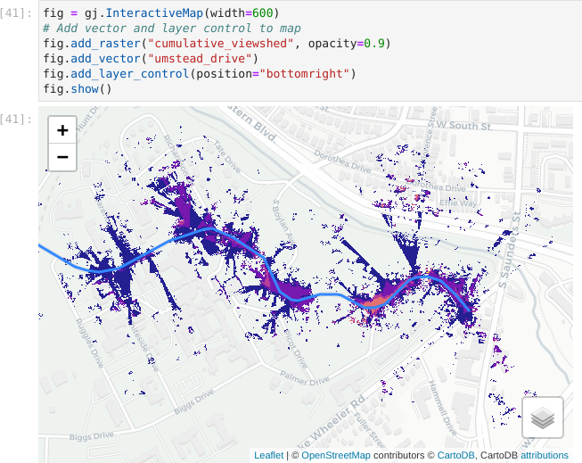
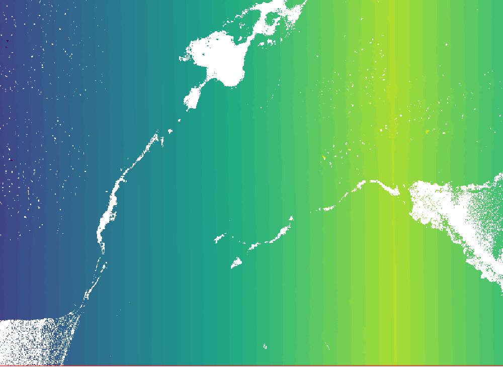
Visual Exposure to a Defined Source
r.viewshed.exposure - Weighted cumulative viewshed analysis defining visual exposure to a source
addon by Zofie Cimburova and Stefan Blumentrath
Get involved! Your contribution is welcome!
Code contributions
GRASS GIS development is GitHub-centered: core, addons, website
- File bug reports or feature requests
- All issues and PR's are publicly visible
- Ask, comment, suggest also in Github Discussions
- "Fork me on GitHub" and suggest changes or fix bugs via pull requests
- Create your own addon! See this nice workshop for a guideline: How to write a Python tool for GRASS

Other contributions are relevant too!
- Translations: we use OSGeo Weblate
- Documentation: start by fixing typos in manual pages, add examples where missing, create cool screenshots, write tutorials in the wiki, etc.
- Contribute material for our social media
- Write a blog post for our website
- Bring your own ideas!
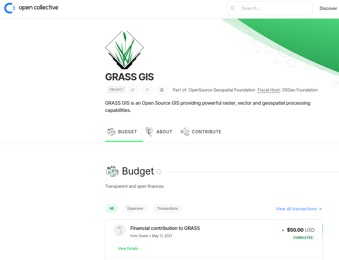
Sponsoring: how to...?
- Individuals:
- Time: organize virtual community event, fix typos, …
- Money: opencollective.com/grass (new!)
- Organizations:
- Time: employee time
- Money: pay developers (companies) to add features or fix bugs
"One of the greatest benefits of GRASS GIS is that its environments gives us a plethora of options for manipulating data and testing/designing our automation/workflow processes."
Student grants program: coding for money!
- GRASS GIS offers a limited number of student grants.
- These can include actual coding, bug fixing, or documentation and the creation of educational resources.
Thanks for your attention!!
neteler.github.io/grass-gis-talks-markus/foss4g2022.html
MarkusNeteler
Bonus material
Creating a Gabor filter bank
i.gabor creates directional filters for image segmentation using i.segment. It requires NumPy and SciPy.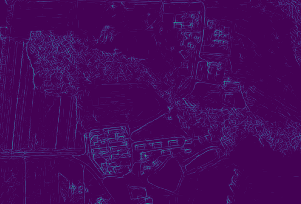
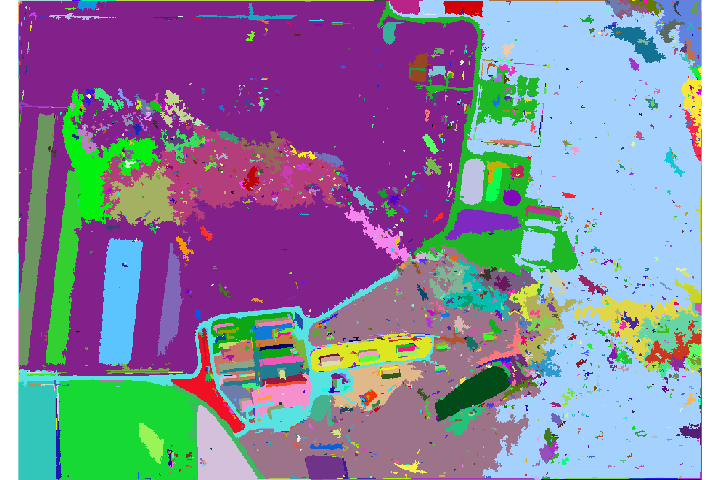
addon by Owen Smith
Hydrologic Parameters Using a Flow Direction Raster
r.accumulate calculates weighted flow accumulation, subwatersheds, stream networks, and longest flow paths using a flow direction map.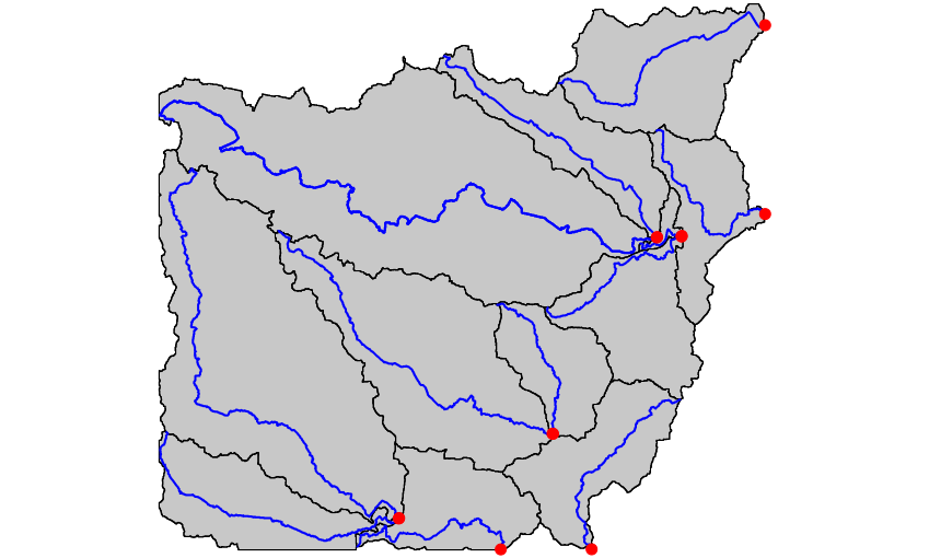
by Huidae Cho
Ecological applications
r.suitability.regions allows to identify suitable regions, e.g., for endangered species, starting from suitability maps.
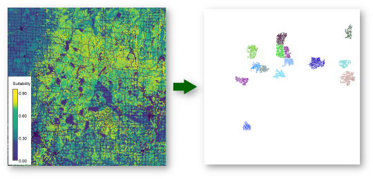
addon by Paulo van Breugel
More data: Sentinel, THREDDS, …, netCDF, CSV
Automated download and import of common datasets i.sentinel, i.modis, i.landsat, r.in.usgs, r.in.nasadem, m.crawl.thredds, t.rast.import.netcdf, …
by Fondazione Edmund Mach, OpenGeoLabs, mundialis, GSoC, NC State University, CONICET, Norwegian Institute for Nature Research, …