
NAME
i.sentinel_1.mosaic - Searches for Sentinel-1 scenes based on current region, downloads, preprocesses, imports and patches.KEYWORDS
imagery, satellite, Sentinel, SAR, download, import, mosaicSYNOPSIS
i.sentinel_1.mosaic
i.sentinel_1.mosaic --helpi.sentinel_1.mosaic [-s] settings=name asf_credentials=name [start=string] [end=string] output=name [outpath=string] bandname=string[,string,...] [external_dem=string] [memory=memory in MB] [--overwrite] [--help] [--verbose] [--quiet] [--ui]
Flags:
- -s
- Apply speckle filter
- --overwrite
- Allow output files to overwrite existing files
- --help
- Print usage summary
- --verbose
- Verbose module output
- --quiet
- Quiet module output
- --ui
- Force launching GUI dialog
Parameters:
- settings=name [required]
- Full path to ESA scihub settings file (user, password)
- Name of input file
- asf_credentials=name [required]
- Full path to asf-credentials file
- Name of input file
- start=string
- Start date ('YYYY-MM-DD')
- Time difference between start and end date must be within 60 days
- end=string
- End date ('YYYY-MM-DD')
- Time difference between start and end date must be within 60 days
- output=name [required]
- Output mosaicked sentinel_1 raster.
- Bandname suffix (e.g. Sigma0_VV_log/Sigma0_VH_log) will be added to output raster
- outpath=string
- Path to temporarily save downloaded files
- bandname=string[,string,...] [required]
- Bands to be processed
- Bands to be processed
- Options: Sigma0_VV, Sigma0_VH, Gamma0_VV, Gamma0_VH
- Default: Sigma0_VV,Sigma0_VH
- external_dem=string
- Path to locally stored DEM
- Path to locally stored DEM to perform terrain correction
- memory=memory in MB
- Maximum memory to be used (in MB)
- Cache size for raster rows
- Default: 300
Table of contents
DESCRIPTION
i.sentinel_1.mosaic is a GRASS GIS addon to download and mosaic Sentinel-1 GRD Data based on the extent of the current computational region. It makes use of both ESA's Scientific Data Hub (to download footprints) as well as the Alaska Satellite Facility API (for Sentinel-1 data download). Login information for both platforms has to be provided. This workaround is necessary as the longterm archive from ESA's Data Hub allows only direct download of max. 1 year old data.The algorithm aims at using as few individual scenes as possible to reduce processing time. The footprint information from ESA's Scientific data hub is used to determine the combination of scenes that leads to full coverage while using the least number of scenes. The import is aborted if full coverage cannot be achieved with the given timerange.
NOTES
If the time interval indicated by start and end is chosen too short, the computational region might not be fully covered. However, if the time interval is chosen too long, the addon requires more time to find the optimal combination of scenes. Due to the short revisit time of Sentinel-1, a time interval of 1-2 weeks to maximum 1 month should be sufficient to create a full coverage. It is advised first to try a short period of time and slowly increase the time interval if the data situation is not sufficient.The available footprint data is usually larger than the actual scene coverage, as Sentinel-1 GRD data contains border noise which is removed during preprocessing.
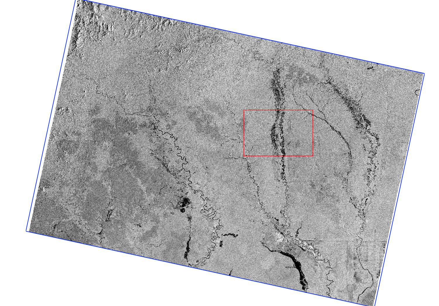
Figure: Sentinel-1 scene and corresponding footprint (blue)
EXAMPLE
Download, preprocess, and import a Sentinel-1 Mosaic
Download, preprocess, and import a Sentinel-1 Mosaic from the beginning of June 2017 based on the current computational region:i.sentinel_1.mosaic settings=/path/to/esa_credentials asf_credentials=/path/to/asf_credentials start=2019-06-01 end=2019-06-15 output=S1_June_2019 outpath=/path/to/temporary/folder memory=6000 bandname=Sigma0_VV,Sigma0_VH
REQUIREMENTS
- i.sentinel toolset (addon)
- i.sentinel_1.download_asf (addon)
- i.sentinel_1.import (addon)
SEE ALSO
i.sentinel.download, i.sentinel_1.download_asf, i.sentinel_1.import, r.patchAUTHOR
Guido Riembauer, mundialis, GermanySOURCE CODE
Available at: i.sentinel_1.mosaic source code (history)
Accessed: Sunday Sep 13 08:22:10 2026
Main index | Imagery index | Topics index | Keywords index | Graphical index | Full index
© 2003-2026 GRASS Development Team, GRASS 8.5.1dev Reference Manual